Drone Photography & 3D scanning
Drone Aerial Photography & Video
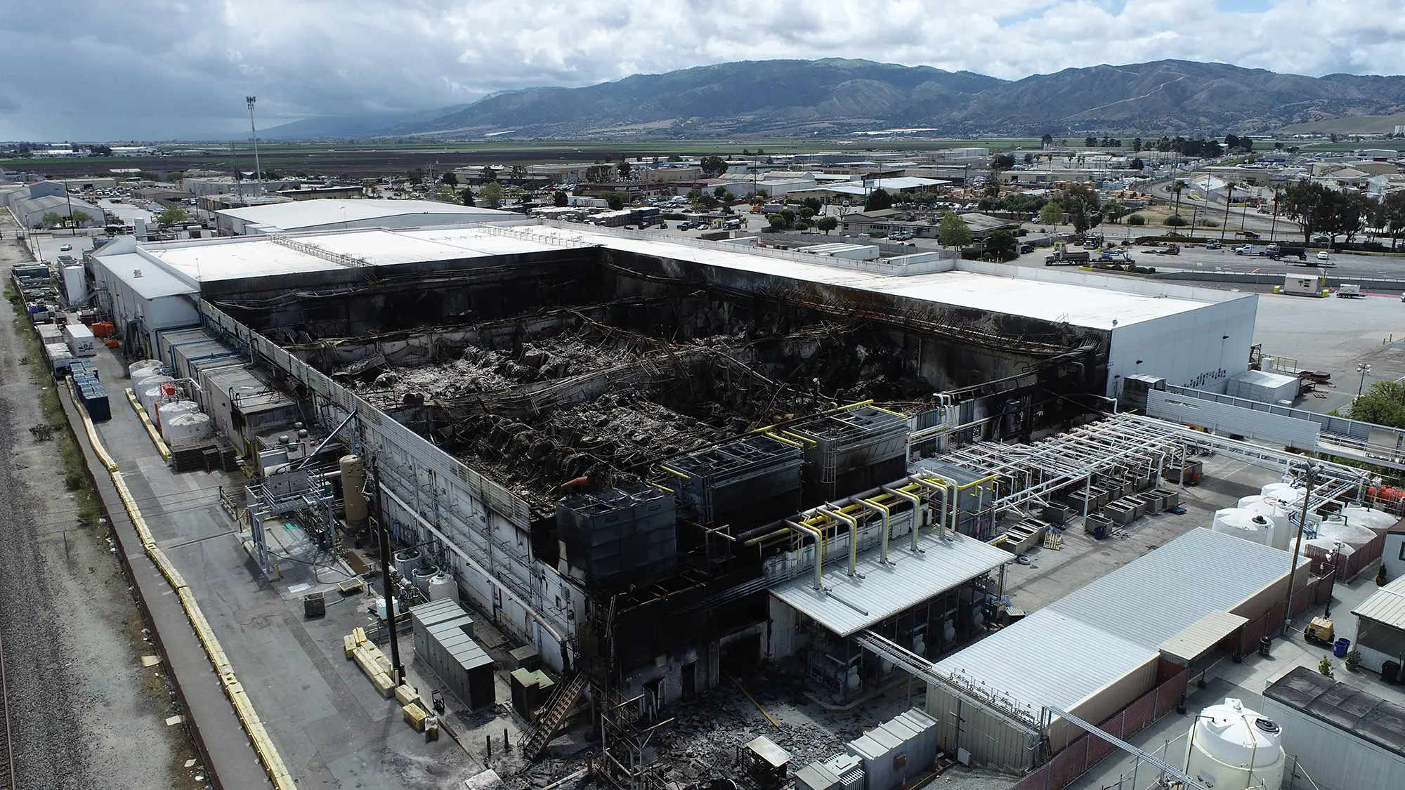
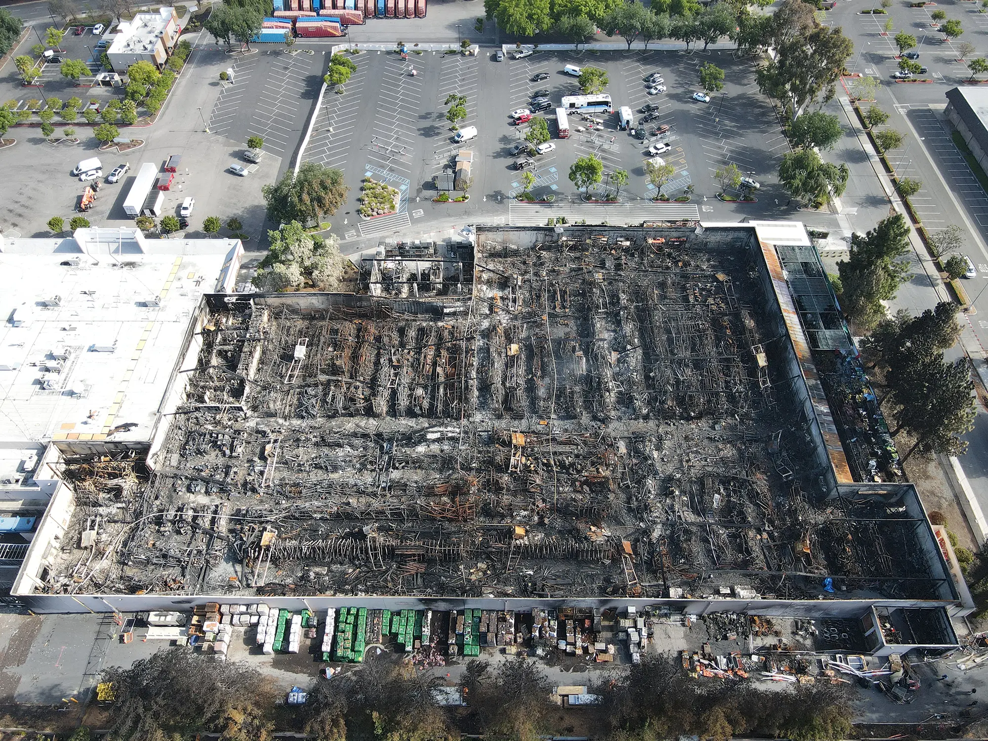
Carman and Associates has extensive experience operating drones, offering safe and accurate data collection in vast, dangerous, or hard to reach areas. Carman & Associates has licensed FAA drone pilots to operate on scene. We provide high definition aerial photography, video, and photogrammetry services. Drone photography can be processed to create 3D models of large or small outdoor locations. Other deliverables include:
- Flythrough videos with side by side map overlay
- High resolution 2D orthomosaic images
- Photo overlay on terrain model viewable in Google Earth.
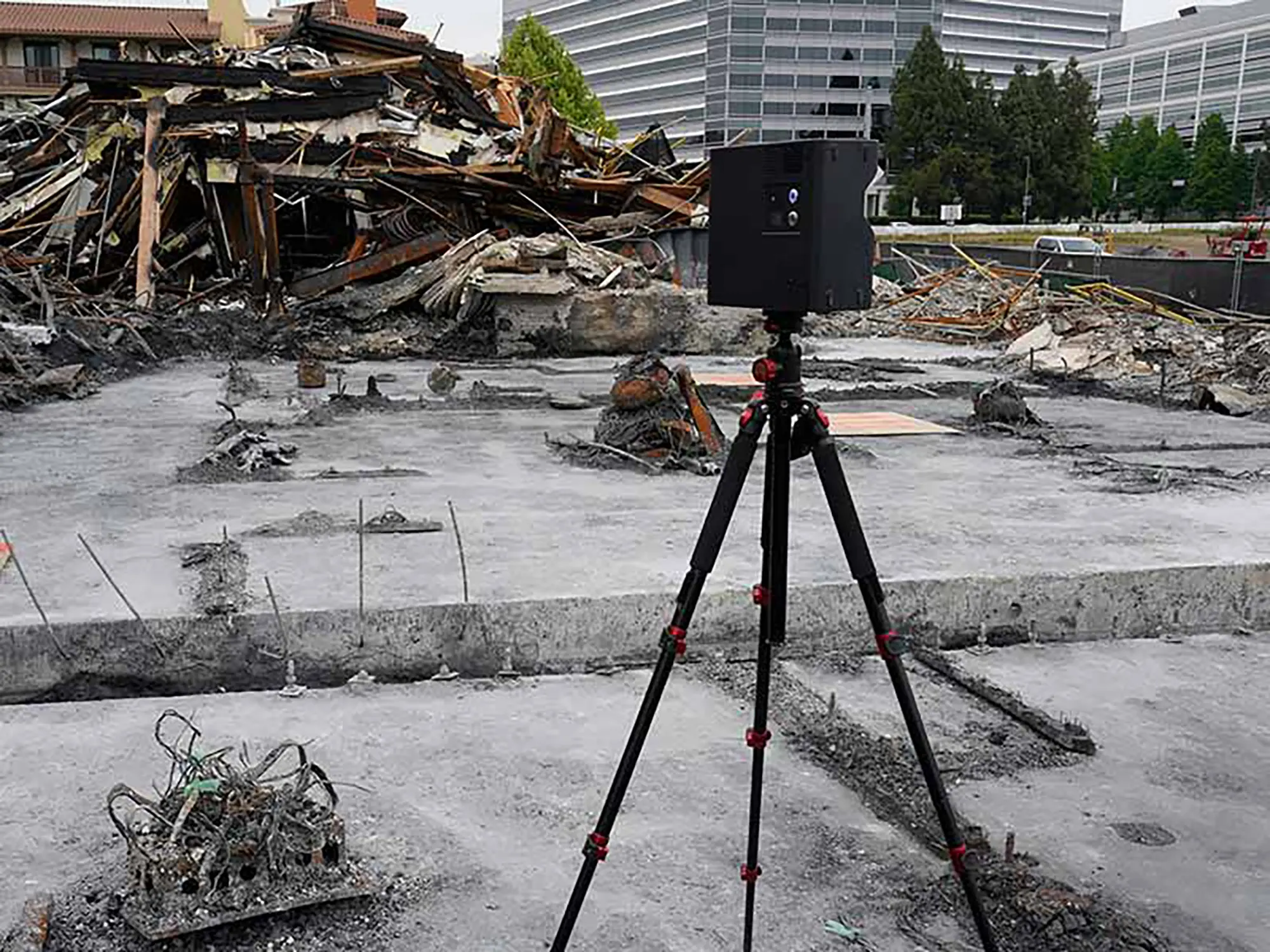
3D Scanning
Carman & Associates uses 3D scanning to accurately and efficiently capture indoor and outdoor 3-dimensional data. Scanned data is captured without physically touching what is being measured. A 3D model and a floor plan diagram of the scanned area can be generated from scan data. Accurate measurements can be taken from point to point within the 3D model. The scanning process also captures high resolution photos. Instead of individual photos, imagine a collection of photos stitched together that allow you to virtually walk back through a scanned site. A virtual walkthrough can be viewed using a phone, computer, and in virtual reality using VR goggles. Evidence and other points of interest can be digitally tagged with hyperlinks, labels, and additional embedded images or videos. Scanning is an excellent tool for comprehensive scene documentation. The ability to generate clear and precise digital records of existing conditions is beneficial in an investigation.
")